
Map a Schertz Street Search
Start with the physical address, not a mailing city or ZIP alone. Schertz crosses Guadalupe, Bexar, and Comal counties, so addresses bearing the same city name can belong to different appraisal districts, clerks, tax offices, and map layers. Run the address through the CityView property locator and the relevant appraisal search first. Keep the situs address exactly as displayed, along with the parcel or property ID, county, subdivision, and legal description. Those details prevent a same-name or same-street error later.
This street directory workflow is best treated as a chain of address records. An appraisal result can identify the owner of record for appraisal purposes and a mailing address. A map can show the parcel and nearby identifiers. A clerk index can connect the legal description to recorded parties. Historic volumes may add a listed resident or phone number for a particular edition. Each source has a distinct purpose, and none should be treated as a complete household roll.
For a Schertz address, use Schertz CityView and Schertz GIS as the local controls before opening a county result. That keeps the Schertz street trail tied to the actual parcel.
- Locate the address or parcel in CityView and determine its county.
- Search that county's appraisal or tax portal by street, owner, or property ID.
- Open the map layer and record adjacent parcel identifiers in street order.
- Use the legal description in the correct county clerk's official-record index.
- Check a regional reverse directory only for the edition and address it actually covers.
Check Schertz County First
Guadalupe County contains the local Schertz satellite clerk counter, but it is not the custodian for every Schertz parcel. Bexar County handles part of the city edge, and Comal County can hold a northern or western address trail. The city GIS maps distinguish City Limits from the ETJ, which is useful when adjacent parcels fall under different county systems. A Schertz mailing label is not a county selection rule.
For a current property search, Guadalupe and Comal use similar BIS-style forms, while Bexar uses separate appraisal and tax systems. The county label, property identifier, situs address, and legal description should travel together in notes. This is a geography check as much as a records check. It keeps a street directory review from mixing parcels that share a road name but not a county custodian. A Schertz boundary label, a Schertz parcel ID, and the Schertz county name belong in the same research note. That Schertz county check protects a Schertz address search from opening the wrong Schertz-area office.
See the Comal County tax account search before comparing mailing and property-location fields.
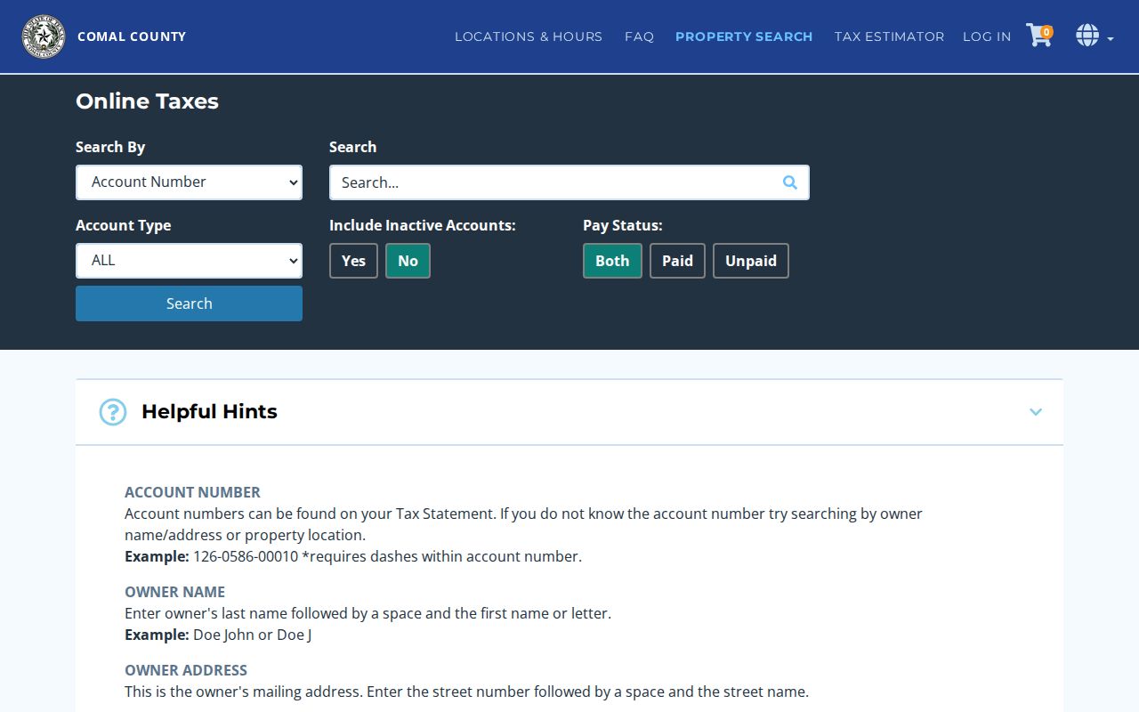
The Comal screen separates an owner mailing address from a physical property location, a distinction that matters when documenting a parcel without assuming who currently occupies it.
Use Schertz Parcel Fields
The Guadalupe and Comal appraisal forms support several ways into an address record. Owner Name, Street Number, Street Name, Property ID, Geographic ID, Subdivision, Neighborhood, and Tax Year are useful controls. The forms advise a simple street name without prefixes, suffixes, or unit numbers when that format is requested. If a full name misses, a last name or first name by itself can be a sensible retry, followed by a comparison of the street and parcel ID. A Schertz query should retain the Schertz street spelling shown by the county form, even when a later source uses a slightly different label. The Schertz property ID and Schertz situs string are better match points than a Schertz mailing label alone.
| Street number and name | Starts an address search; use the county form's simple-street format. |
|---|---|
| Property or geographic ID | Provides the strongest bridge from a map point to one appraisal record. |
| Subdivision or neighborhood | Helps narrow similar street names or browse a development. |
| Tax year | Separates the current assessment view from another available year. |
| Owner name | Finds appraisal-owner entries, then requires an address comparison. |
Open the Comal Appraisal District property search to review the county-specific field set.
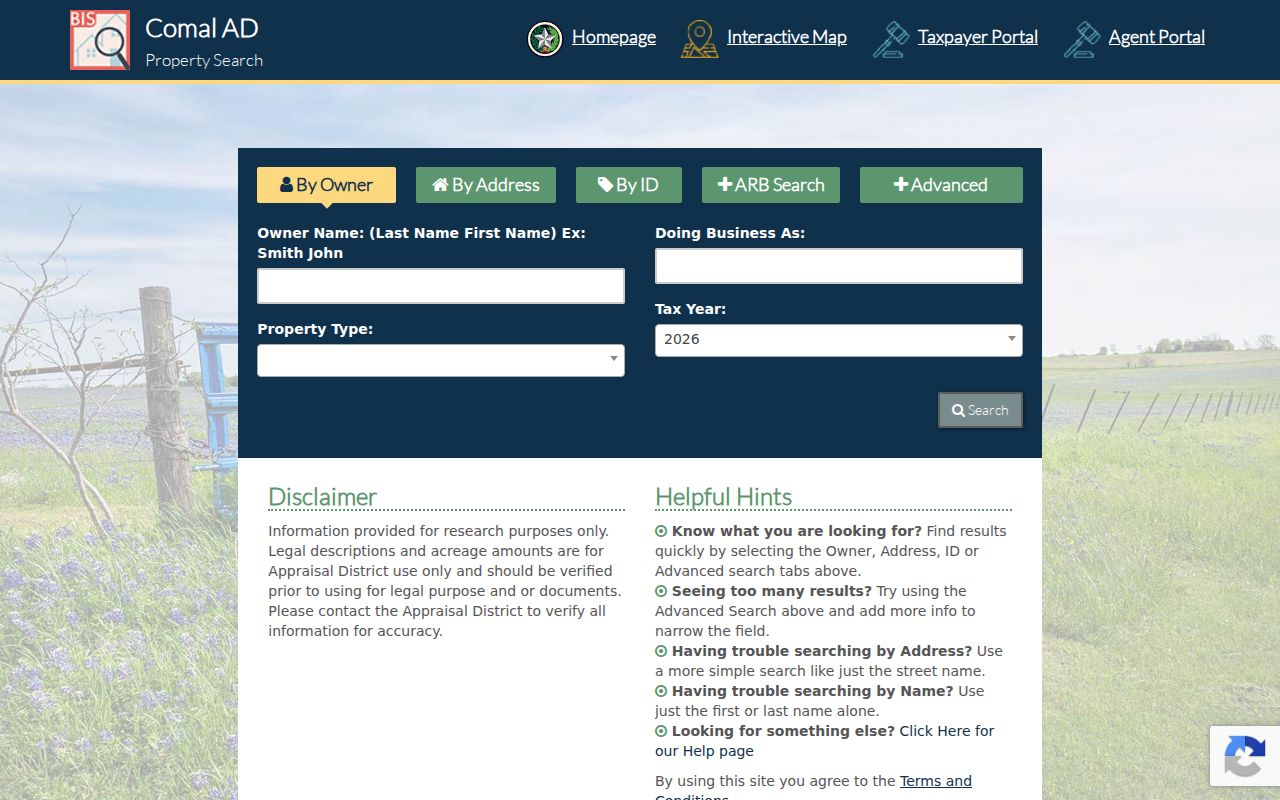
The advanced controls support a careful parcel search, but a result remains an appraisal record rather than a title opinion or a proof of current residency.
Walk a Schertz Street Map
After locating the subject parcel, use the public city parcel and address layers to move outward along the street. Click the address point or polygon, note the visible street label and parcel identifier, then inspect the adjoining features. The layers can provide city-limit, ETJ, zoning, thoroughfare, building-footprint, and address-point context. They explain where an address sits, but the county appraisal and clerk records supply the associated record trail.
Roads such as FM 78, FM 1103, FM 3009, Schertz Parkway, Live Oak Road, and Lower Seguin Road can also serve as cross-street anchors when older material lacks a modern street string. The city has not published a confirmed citywide street-renumbering year. When an old number does not line up, preserve cross streets, lot and block data, and the county legal description instead of forcing a modern match. Schertz map context is especially useful where a Schertz mailing address meets an ETJ line or a Schertz county boundary. Keep the Schertz map date with the Schertz parcel note, because Schertz layer currency can differ from a county record date.
Review the Schertz GIS parcel and address layers before beginning a parcel-by-parcel street pass.
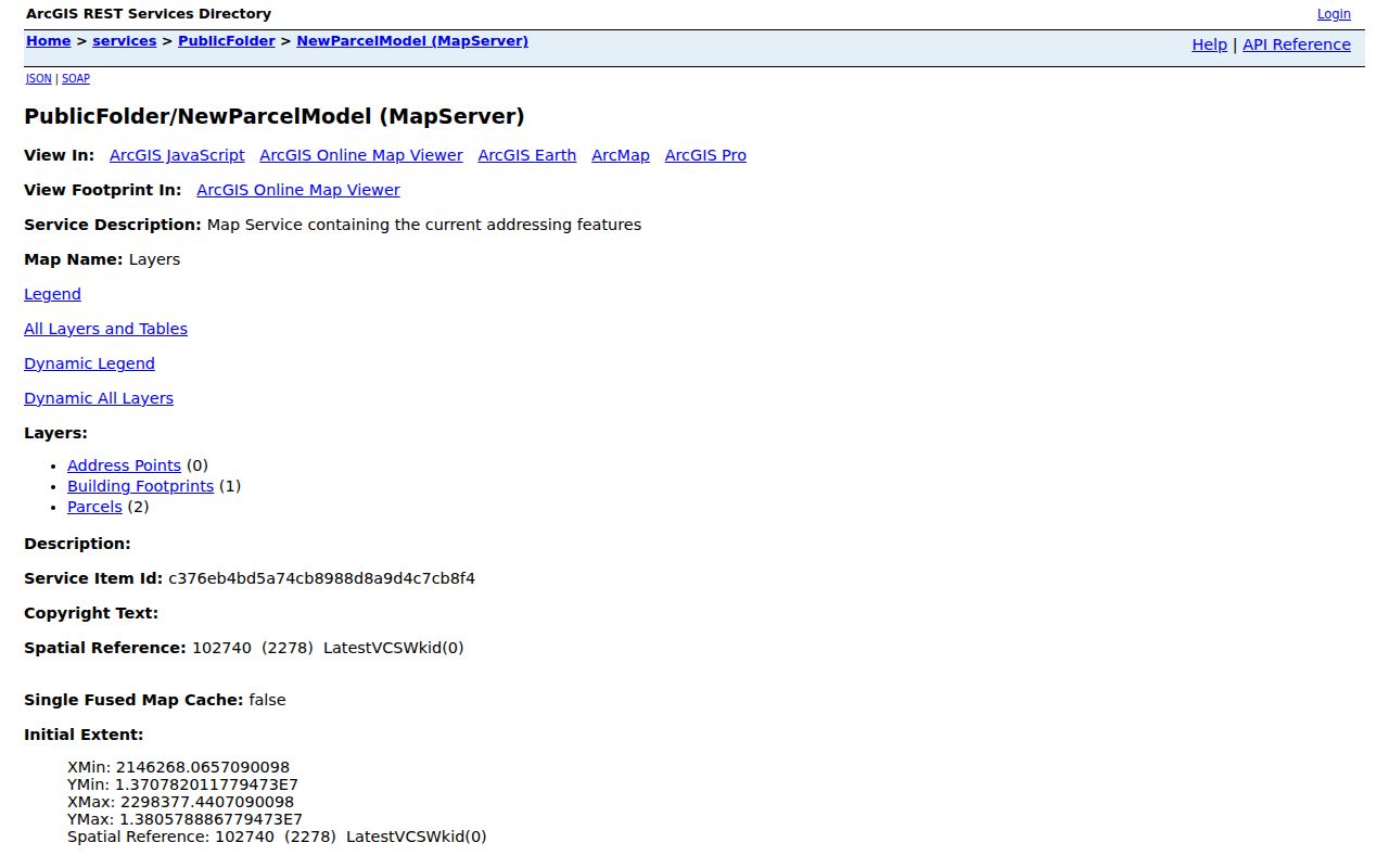
The GIS view is a practical starting point for preserving parcel order and boundary context before opening separate county records.
Trace Schertz Street Directory Records
Several address-keyed sources can be used together, but they do not reveal the same thing. An appraisal card connects a parcel to an appraisal owner, situs, value, exemptions, and legal description. The tax account adds payment-oriented fields. CityView can show an address-linked permit, inspection, planning matter, or code path. The official-record index contains recorded parties and instruments. A voter search is person-specific, not a browse tool for an entire street.
| Address record | Local custodian | Useful fields | Access path |
|---|---|---|---|
| Appraisal parcel | Guadalupe, Bexar, or Comal appraisal district | Owner, mailing and situs address, value, exemptions, legal description | Free county search; written records route |
| Tax account | County tax office | Account, parcel address, mailing address, value, payment data | County-specific online search |
| Parcel map | Schertz or county GIS | Address point, parcel geometry, adjacent IDs, boundary layers | Public map or layer query |
| Recorded instruments | Correct county clerk | Grantor, grantee, instrument, date, legal description, plat | Index, plain-copy, or certified-image route |
| CityView activity | City of Schertz | Permit, inspection, planning, and code activity by address | Public portal with expanded account tools |
The parcel ID and legal description make the chain reliable. Use the street name for orientation, then carry the county and parcel details into each later search. Do not turn one property result into a claim about everyone on a block. For Schertz records, a Schertz street label is only the starting label. The Schertz parcel and county are the durable identifiers. A Schertz record chain is strongest when the Schertz address, Schertz parcel, and custodian county agree.
Follow Schertz CityView Addresses
CityView is the city-level address trail for permits, inspections, planning applications, code complaints, and contractor registration. Its property locator accepts a street address or parcel number. The code module documents a sequence of Start, Location, Complainant, Uploads, Review and Submit, with the address selected later in the process. A permit or inspection can help date work at a structure; it does not identify every person connected with that address.
Use an address-linked city item as corroboration beside the parcel and deed trail. When the city record is important and the public result is incomplete, the Texas Public Information Act provides a written-records path. The city describes an online request system, but it can provide only existing records and may redact protected information. Schertz CityView is a Schertz municipal source, so pair a Schertz permit or complaint trail with the correct county parcel record. Schertz CityView can support a Schertz address timeline, while the Schertz county systems provide the parcel-side record.
Inspect the Schertz CityView code complaint workflow to see its address-selection process.
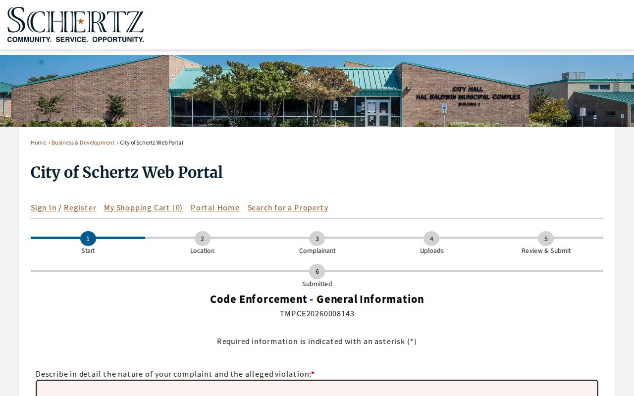
The form illustrates an official address-based process, while also showing why a municipal case is not a general roster of people at the location.
Search Schertz Deed Chains
Move from parcel to recorded document with the legal description, lot and block, subdivision, party name, or recording date. In a purchase instrument, the buyer is the grantee and the seller is the grantor. Search the seller backward as an earlier grantee, then repeat while comparing the description and instrument data. A chain may pass through an estate, trust, corporation, lender, foreclosure trustee, or probate representative, so a mailing address should not be read as a later residence.
The correct clerk depends on the parcel. Guadalupe County Official Records offers a separate pre-1970 index link and describes historic books dating to the 1820s. Bexar's official search provides free viewing and plain copies, while its certified copies have a stated fee. Comal ROAM describes records from “Sovereignty–Present” and an official-image route. County clerks do not guarantee clear title, so a question about title validity needs the appropriate professional advice.
A Schertz deed search must stay with the Schertz parcel's county. The Guadalupe Schertz satellite is convenient only for the Guadalupe County part of Schertz.
Compare the Bexar County tax account search with an official-record search when the address lies on the Bexar side of Schertz.
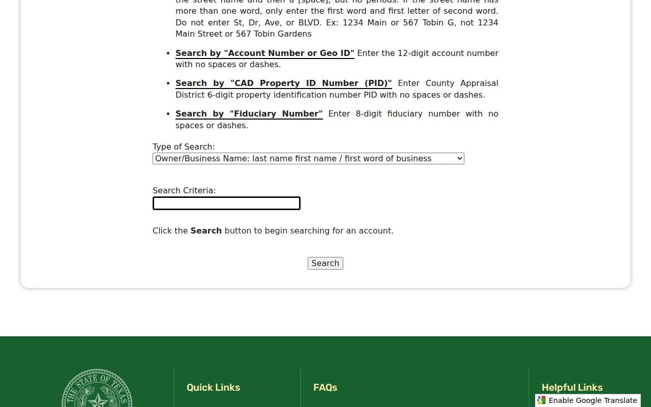
The Bexar form supports owner, property-address, account, Geo ID, and PID routes, giving the researcher several ways to confirm the parcel before following its deed trail.
Read Schertz Street Listings
For a historic street directory listing, the nearest documented shelf is regional. San Antonio Public Library Texana/Genealogy holds San Antonio city directories on microfilm from 1877 through 1970, incomplete hard copies from 1960 through 2009, and Cole “Blue Book” criss-cross volumes from 1960 through 2009. The Blue Book arranges individuals and businesses by street name, house number, and phone number. Its coverage must be checked volume by volume before treating it as evidence for a Schertz address.
Start with the exact number and street spelling, check nearby numbers and cross streets, and compare earlier and later editions. Telephone directories, Seguin volumes at the San Antonio Genealogical and Historical Society, and census material can help bridge a gap. The separate Schertz city directory collections guide explains the documented shelves and years in more detail.
Use a Schertz name, a Schertz address, and the older Schertz-area place labels when testing whether a regional volume reaches the family or street in question.
- Parcel
- A mapped unit of land with county identifiers and a legal description.
- Situs address
- The physical property location, which can differ from the owner's mailing address.
- Plat
- A recorded subdivision or survey map used to connect lots, blocks, and descriptions.
- Criss-cross directory
- A volume arranged by street and house number rather than by surname.
Separate Schertz ZIPs and Counties
Schertz-area addresses can use 78154, 78108, or 78132. The primary 78154 area includes central and eastern Schertz, while 78108 can carry a Cibolo mailing label and 78132 can use a New Braunfels label. None of those postal labels chooses the recorder or appraisal district. USPS is the address-level postal verifier, and city GIS is the better next check for city-limit, ETJ, and county context.
This is the local geography issue that most often affects a street directory pass. Preserve the ZIP returned for the record date, but use the parcel and county to select the county portal. Older sources may say Cut-Off, Seguin, New Braunfels, a rural route, or an old cross street rather than the current Schertz and ZIP format.
A Schertz postal label, a Schertz city limit, and a Schertz county record can point to different boundaries, so preserve all three.
Respect Schertz Street Limits
A street directory can document public property and historical listing evidence, but it cannot establish a full current household. County voter tools require person-specific identity information and do not provide an unrestricted street-wide browse. Protected voter addresses can be replaced with an asterisk or substitute address. Driver-license address data are protected by federal law, and Schertz identifies utility-account information as confidential.
An appraisal-owner entry, a phone listing, a permit, or a deed is a dated record with a narrow meaning. Treat it as one source, retain the date and county, and verify important facts with the custodian. Do not publish a street-level compilation as though it were an official census.
That caution applies to every Schertz address result, whether the Schertz source is a city portal, a county search, or a historic volume.
Lawful use. Use Schertz address records for personal, lawful research and civic or family-history questions. Never use an address trail to stalk, harass, intimidate, or harm another person.